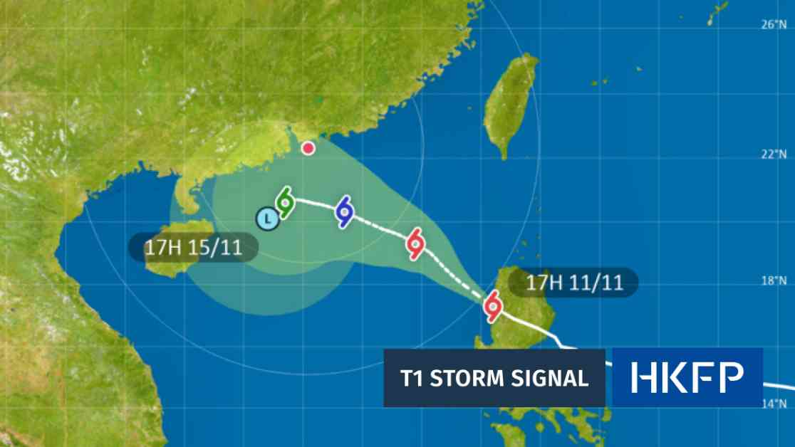
Hong Kong issued a T1 storm warning as Tropical Cyclone Toraji approached the city. The Standby Signal No. 1 was raised on Monday night as the storm came within 800 kilometers of Hong Kong. The Hong Kong Observatory forecasted that the winds would strengthen with squally showers due to the combined effect of Toraji and the northeast monsoon.
There is a possibility of a higher T3 typhoon signal being raised depending on the storm’s progress. The government forecaster mentioned that Toraji may be close to the Pearl River Estuary on Thursday and could weaken at the same time. The decision to issue a higher Tropical Cyclone Warning Signal will depend on various factors such as the distance between Toraji and the Pearl River Estuary, its intensity, and local wind conditions.
Rain and wind are expected to continue into the weekend, with a brief bright spell on Saturday before more rain next week, as per the Observatory’s forecast. The No.1 signal advises people to take the tropical cyclone into account when planning activities and be cautious of potential strong winds over offshore waters.
Tropical cyclones are becoming more destructive due to warming seas caused by the climate crisis. Over 90% of excess heat in the atmosphere is being absorbed by oceans, leading to stronger cyclones. The European Union’s Copernicus Climate Change Service stated that 2024 is likely to be the warmest year on record, with temperatures exceeding 1.5 degrees Celsius above pre-industrial levels.
As a journalist based in Hong Kong, I have covered various local environmental issues, including climate inequality and marine biodiversity. I have also explored how Hong Kong’s arts scene reflects the changing city. It is crucial to raise awareness about the impact of climate change and the importance of taking action to mitigate its effects. By understanding the science behind these natural disasters, we can better prepare and adapt to future challenges.


